🔬 Science 2d ago · Stephanie Pappas

We now have an incredibly detailed map to help predict which areas of LA are the most at risk from 'The Big One'
Live Science
Live Science news
View Channel →
We now have an incredibly detailed map to help predict which areas of LA are the most at risk from 'The Big One'
Source ↗ 👁 1 💬 0
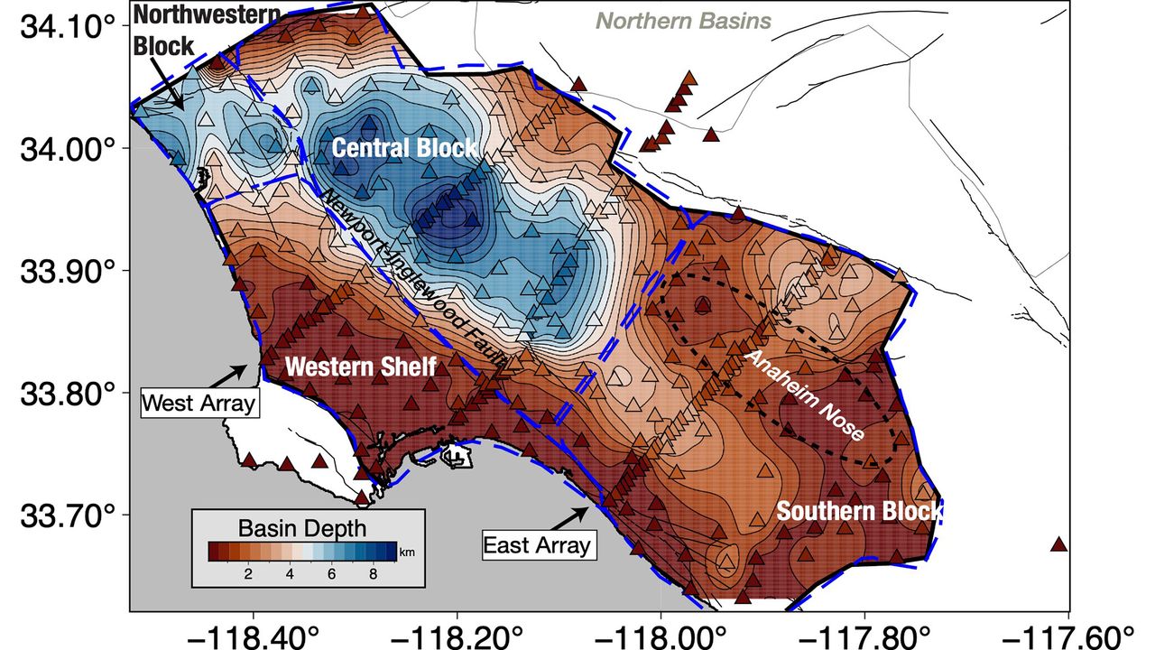
Scientists have a new view of the ground under Los Angeles, and it's a bit shaky. The 3D model of the Los Angeles basin shows that downtown LA is underpinned by up to 6.2 miles (10 kilometers) of sediment, which will likely amplify shaking from any earthquake that hits the region. That's not entirely new information, but the underground map is more precise than ever before, and it should help earthquake scientists better understand which areas of the city are most vulnerable. "With this improved

Comments (0)

Sign in to join the discussion

More Like This

Khan addresses Polanski in Urdu at London assembly, mocking Green leader’s byelection video – UK politics live
Environment | The Guardian · 5h ago
Peptides are spreading on social media. Here's how platforms can better protect public health
Medical Xpress - latest medical and health news stories · 5h ago
📰
A Feather Found in Dinosaur Poop Might Explain How Birds Beat Extinction
NYT > Science · 5h ago
Mouse study identifies bile acid pathways that may reduce liver fat
Medical Xpress - latest medical and health news stories · 5h ago
AI tool nears psychiatrist-level accuracy
Medical Xpress - latest medical and health news stories · 5h ago
Robotic help in high-risk twin pregnancies: Panoramic guidance for a flexible laser scope
Medical Xpress - latest medical and health news stories · 6h ago